Top 10 Best Hiking Trails in California | Northern California | Southern California | Hike Map
As the morning fog lifts off the majestic Sierra Nevadas, revealing the sun-kissed peaks, I lace up my boots, ready to embark on another adventure. Welcome, fellow trailblazers, to the golden state’s hidden gems – the best hiking trails in California.
Each path has its own story, etched in my memory, waiting to be shared with you. From the rugged coastline of Big Sur to the towering redwoods of Sequoia, I’ve traversed these trails, felt the crunch of leaves underfoot, and breathed in the crisp, mountain air.
This isn’t just a list; it’s a collection of personal experiences, of sunrises witnessed and challenges overcome.
Let me guide you through these paths less traveled, where every turn brings a new surprise, and every ascent, a new perspective.
Let’s discover together why California’s trails are more than just paths in the wilderness – they’re journeys into the heart of nature itself.
So, tighten your hiking boots and fill your water bottles. We’re about to embark on an unforgettable journey through California’s best hiking trails.
And who knows? By the end of this article, you might just find your next adventure.
List of Best Hiking Trails in California
Here are the Best Hiking Trails in California:
| Trail Name | Location | Difficulty | Description |
|---|---|---|---|
| Half Dome | Yosemite National Park | Challenging | Leads to the top of an iconic granite rock formation with panoramic views of the valley and the High Sierra. |
| Yosemite Falls Trail | Yosemite National Park | Strenuous | Leads to the top of North America’s tallest waterfall and offers incredible views of the park. |
| Mist Trail | Yosemite National Park | Popular | Brings you close to two spectacular waterfalls, Vernal and Nevada Falls, and lets you feel the mist on your face. |
| Potato Chip Rock via Mt. Woodson Trail | Poway | Moderate | Leads to a unique rock formation that looks like a potato chip and is perfect for photo ops. |
| Lost Palms Oasis Trail | Joshua Tree National Park | Moderate | Leads to a hidden palm oasis in the middle of the desert and offers views of the Salton Sea. |
| McWay Falls Trail | Big Sur | Easy | Leads to a viewpoint of a stunning waterfall that drops into the ocean and a turquoise cove. |
| Mount Tamalpais East Peak Loop Trail | Mount Tamalpais State Park | Moderate | Circles around the highest peak in Marin County and offers sweeping views of the bay, the city, and the ocean. |
| Mount Baldy Loop Trail | Angeles National Forest | Hard | Takes you to the summit of Mount San Antonio, the highest peak in Los Angeles County and one of the most prominent peaks in Southern California. |
| Fern Canyon Loop Trail | Prairie Creek Redwoods State Park | Easy | Takes you through a lush canyon lined with ferns and mosses and featured in Jurassic Park 2. |
| Bumpass Hell Trail | Lassen Volcanic National Park | Easy | Leads to a geothermal area with boiling mud pots, steaming fumaroles, and colorful pools. |
Half Dome – Conquering The Majestic Granite Giant
The Half Dome hike in Yosemite National Park is an odyssey, an adventure not meant for the faint-hearted but rewards you with an unparalleled vista of the High Sierra.
As I traversed this formidable trail, I felt an adrenaline-fueled awe. The scale of the massive granite monolith, and the sweep of the landscape below, all humbled me, making me realize how small we are amidst the grandeur of nature.
Consider reading: Best Hikes in Yosemite National Park
Key details of Half Dome Hike Trail:
| Information | Data |
|---|---|
| Elevation of Half Dome above Yosemite Valley | Nearly 5,000 feet |
| Elevation of Half Dome above sea level | 8,800 feet |
| Number of people reaching the summit of Half Dome annually | Thousands |
| Permit requirement for hiking Half Dome when cables are up | Yes |
| Availability of permits for day hikers by lottery | March |
| Availability of permits for day hikers two days in advance | Limited number |
| Length of the hike to Half Dome (round-trip) | 14 to 16 miles |
| Recommended fitness level for the hike to Half Dome | Not recommended for those who are out of shape or unprepared |
| Notable views during the hike | Vernal and Nevada Falls, Liberty Cap, Half Dome, and panoramic views of Yosemite Valley and the High Sierra |
| Well-broken-in boots with good ankle support, gloves with good grip, and plenty of water | Allows climbing the last 400 feet to the summit without rock climbing equipment |
| Recommended items to bring for the hike | Distance from the trailhead parking lot to Happy Isles |
| Temperature difference at the summit of Half Dome compared to Yosemite Valley | Typically 15°F (8°C) to 20°F (11°C) cooler |
| Wildlife encountered along the trail | Black bears, squirrels, Steller’s jays, and chipmunks |
| Guidelines for hikers regarding wildlife | Keep food within arm’s reach and never feed the animals |
| Starting point of the hike | Happy Isles (shuttle stop #16) |
| Distance from trailhead parking lot to Happy Isles | About a half-mile |
| Distance from Curry Village to Happy Isles | About 3/4 of a mile |
Tip: Grab your hiking poles, strap on your most comfortable hiking boots, and don’t forget a good pair of gloves for the cable section.
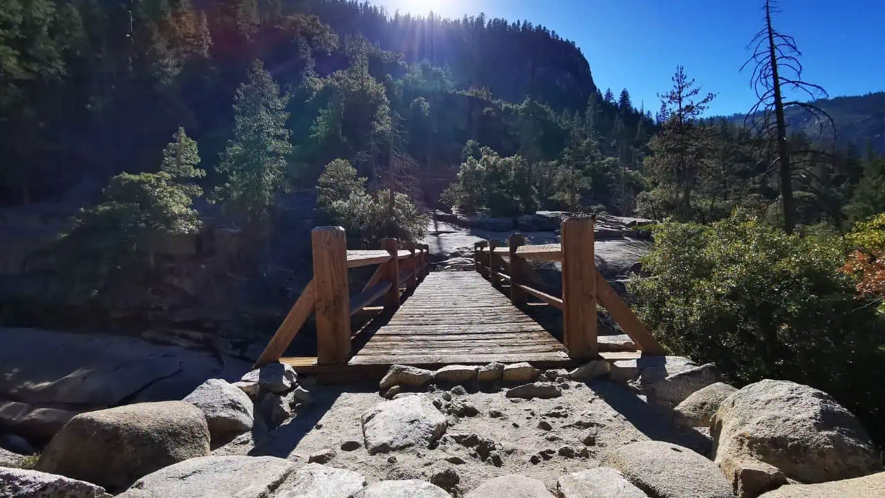
Yosemite Falls Trail – Dancing With The Falls
You haven’t truly experienced Yosemite National Park until you’ve hiked the Yosemite Falls Trail.
Ascending to the summit of North America’s tallest waterfall is a journey full of wonder.
The echoing roar of the falls is a constant companion, and the climax, the view from the top, is like a painter’s dream captured in real life.
Key details of Yosemite Falls Trail:
| Key Details | Yosemite Falls Trail |
|---|---|
| Location | Yosemite National Park |
| Description | Historic trail leading to the top of North America’s tallest waterfall, Yosemite Falls |
| Elevation of Yosemite Falls | 2,425 feet above the Valley floor |
| Trail Start | Near Camp 4 |
| Trail Sections | 1. Columbia Rock: 2-mile round trip, 1,000 ft elevation gain, moderate difficulty, 2-3 hours |
| 2. Top of Yosemite Falls: 7.2-mile round trip, 2,700 ft elevation gain, strenuous, 6-8 hours | |
| Views | Spectacular views of Yosemite Valley, Half Dome, Sentinel Rock |
| Seasonal Conditions | Spring: Peak waterfall; Summer: Hot and dry conditions; August: Low water levels; Winter: Snow-free lower trail |
| Safety Tips | Start early; Stay hydrated; Stay on the trail; Watch out for steep drop-offs and ledges |
| Amenities | No drinking water along the trail; the Nearest restrooms in Camp 4; Trailhead is served by Valleywide Shuttle |
| Prohibited Items | Pets, bicycles, strollers |
Tip: Start early to avoid the heat, and make sure you’re carrying plenty of water and some snacks. The way up is tough but worth every step.
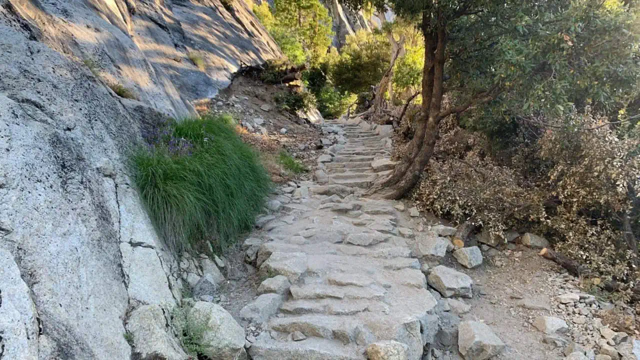
Mist Trail – In The Veil Of Nature’s Shower
The popular Mist Trail provides an unforgettable, and yes, misty experience.
As I embarked on this adventure, I couldn’t help but revel in the beauty of Vernal and Nevada Falls up close.
With the exhilarating feel of the misty breeze on my face, the hike seemed more like a peaceful communion with nature rather than a mere walk.
Key details about Mist Trail:
| Detail | Information |
|---|---|
| Trail Name | The Mist Trail |
| Location | Yosemite Valley |
| Hike Length to Vernal Fall | 3 miles (4.8 km) round trip |
| Hike Length to Nevada Fall | 7 miles (11 km) round trip |
| Additional Length from Curry Village | 1.5 miles (2.4 km) |
| Trailhead Elevation | 4,000 feet (1,200 meters) |
| Elevation Gain to Vernal Fall | 1,000 feet (300 meters) |
| Elevation Gain to Nevada Fall | 1,900 feet (580 meters) |
| Recommended Time to Visit | Peak runoff (typically April to June) |
| Recommended Time of Day | Start early morning or late afternoon |
| Duration | 2 to 5 hours, depending on the distance covered |
| Scenic Views | Vernal Fall, Nevada Fall, Liberty Cap, the back of Half Dome from the Muir Trail return segment |
| Difficulty Level | Medium (can be strenuous if hiking to the top of Nevada Fall) |
| Parking Availability | Eastern half of Yosemite Valley with a free shuttle bus to the trailhead near Happy Isles |
| Nearest Facilities | Bathrooms and snacks available at Curry Village (3/4 mile west of the trailhead) |
| Trail Conditions | Trail can be wet and stone steps can be slippery, exercise caution near the river |
| Safety Caution | More fatalities occur on the Mist Trail than in almost any other area in Yosemite due to strong currents in the river. Exercise caution near the river. |
Tip: A rain jacket or a poncho is a must for this trail as things can get pretty damp. Also, watch your footing on the slippery rocks.
Potato Chip Rock via Mt. Woodson Trail – A Slice Of Unique Formation
Trekking to Potato Chip Rock in Poway is a fascinating journey. The thin, curvilinear rock formation resembling a potato chip is not only interesting but also instigates a sense of thrill.
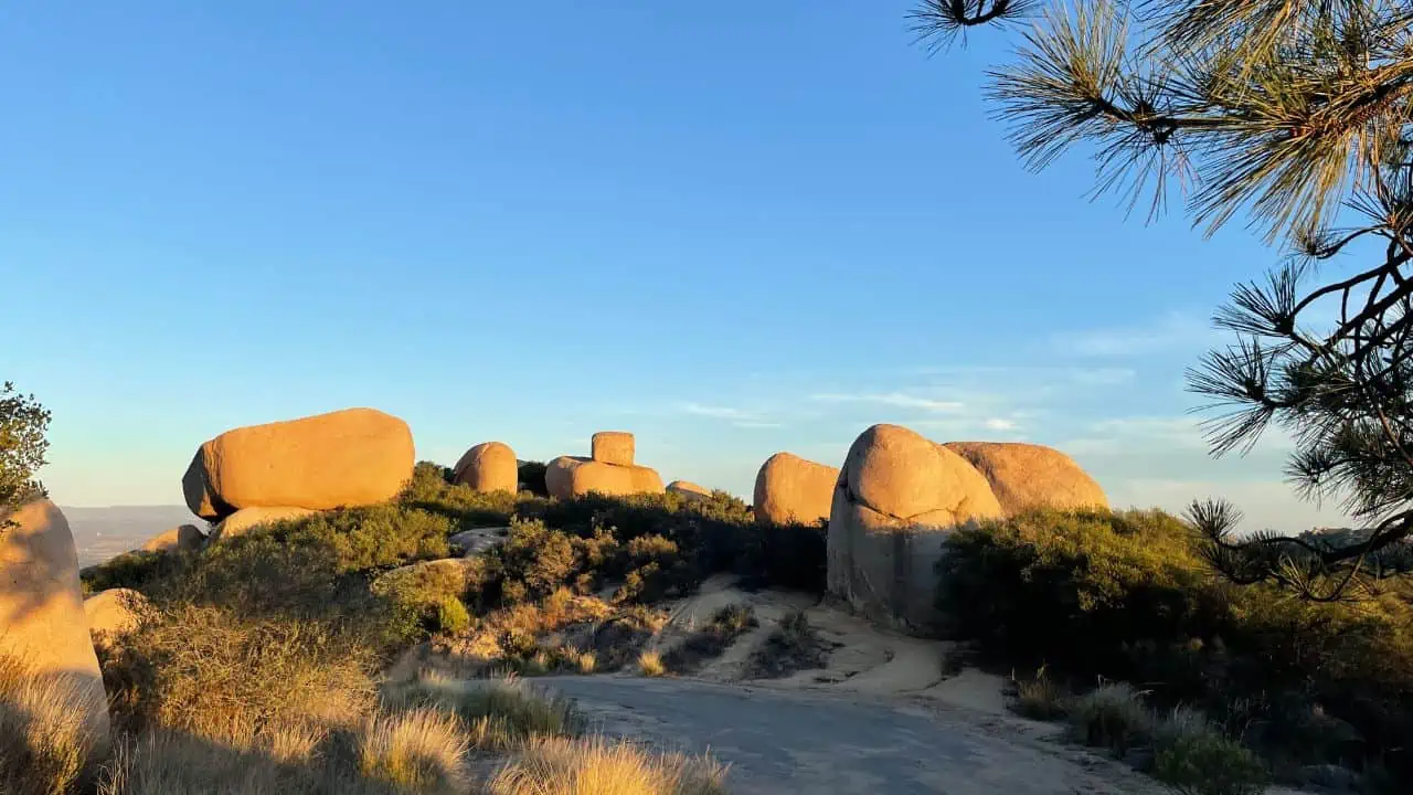
While standing on the edge of the ‘chip’, with the expansive vista around me, I couldn’t help but capture this surreal moment with my camera.
Key details about Potato Chip Rock via Mt. Woodson Trail:
| Key Details | Information |
|---|---|
| Trail | Potato Chip Rock hike |
| Location | San Diego County |
| Difficulty | Challenging due to uphill climb |
| Amenities | Bathrooms, picnic tables, ample parking |
| Non-resident fee | Applies on weekends and holidays |
| Safety | Act responsibly; risky behavior can lead to injuries |
| Water Requirement | Recommended 1L (author suggests 3L) |
| Photo Tips | Hike with another person for better photos; selfies don’t work well |
| Views | Beautiful views of Lake Poway and surrounding mountains |
| Popular Route | Starts at Lake Poway park |
| Ending Point | Summit of Mt Woodson |
| Return Route | Return the way you came |
| Additional Resources | Detailed directions, maps, and video guides available on Hiking Guy website (by Cris Hazzard) |
Tip: It can get crowded, so an early start is recommended. Also, be careful while taking pictures on the rock. Safety first!
Lost Palms Oasis Trail – A Desert Surprise
Hidden amidst Joshua Tree National Park’s rugged desert, the Lost Palms Oasis trail led me to a secluded palm grove, a contrast as refreshing as an oasis.
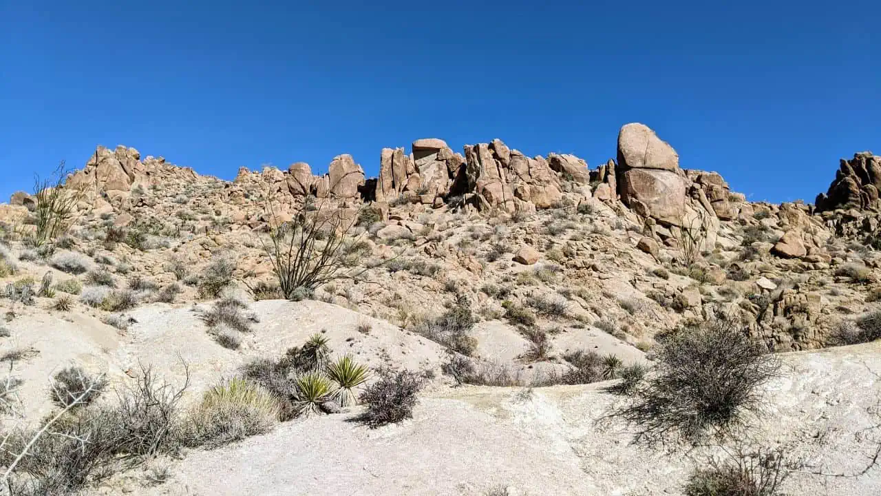
From the harsh desert to a sudden burst of lush palms, and the panoramic view of the Salton Sea, it was like living in a paradox.
Key details about Lost Palms Oasis Trail:
| Trail Name | Lost Palms Oasis Trail |
|---|---|
| Location | Joshua Tree National Park |
| Length | 7.5 miles |
| Elevation Gain | 500 feet |
| Starting Point | Cottonwood Spring |
| Trail Type | Out-and-back |
| Difficulty | Challenging |
| Scenery | Rolling desert hills, Lost Palms Canyon, Oasis |
| Final Section | Rocky with a strenuous climb to exit |
| Flora | Fan palms, variety of desert plants |
| Fauna | Diverse wildlife |
| Combined Trail | Mastodon Peak trail |
| Pet-Friendly | No (Service animals permitted) |
| Best Times to Hike | Day, dawn, or dusk in winter, spring, or fall |
| Trail Surface | Mix of dirt, sand, and rock with steep, rocky steps and scrambling required |
Tip: Don’t forget to carry a hat, sunscreen, and lots of water. It can get hot in the desert.
McWay Falls Trail – Serenity in a Snapshot
One of Big Sur’s gems, the McWay Falls trail is like a postcard brought to life.
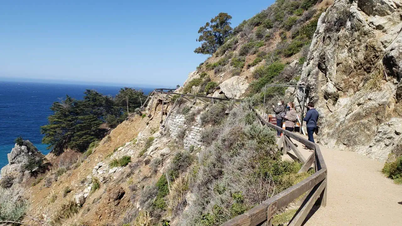
The short stroll to the viewpoint where a stunning waterfall meets a turquoise cove left me mesmerized. The pristine scene appeared to be straight out of a fantasy novel.
Key details of McWay Falls Trail:
| Information | Details |
|---|---|
| Location | Julia Pfeiffer Burns State Park along Highway 1 |
| Trail Length | 0.64 mile |
| Elevation Gain | 50 feet |
| Difficulty | Easy |
| Trail Type | Flat and wide |
| Accessibility | Suitable for beginners |
| Alternative Routes | Path leading to the area above the falls |
| Views | Southern and northern coastal views, panoramic views |
| Waterfall | McWay Waterfall |
| – Height: 80 feet | |
| – Flows directly into the ocean | |
| Ruins | Old “Waterfall House” ruins |
| Name Origins | McWay Falls named after Christopher McWay |
| Creek named after Julia Pfeiffer Burns | |
| Park Access | Off Highway 1, 37 miles south of Carmel |
| 12 miles south of Pfeiffer Big Sur State Park | |
| Parking | Parking fee within the park |
| Free parking available outside along the west side of Hwy 1 | |
| Crowds | Can get crowded, especially during weekends and holidays |
| Recommendations | Wear sturdy shoes |
| Stay away from the edge due to steep cliffs | |
| Take time to enjoy the scenery | |
| Conservation Efforts | Removal of invasive non-native plants |
| Time to Complete | Under 30 minutes |
| Park Ranger Activity | Working to remove invasive non-native plants |
Please note that the table includes two sections for the “Waterfall” and “Name Origins” to provide separate details within those categories.
Tip: Bring your camera along, and make sure to arrive early or late to avoid the crowds. This place is a must-visit during sunset.
Mount Tamalpais East Peak Loop Trail – Where Land Meets Sky
As I tread around the highest peak of Mount Tamalpais State Park, the view left me spellbound.
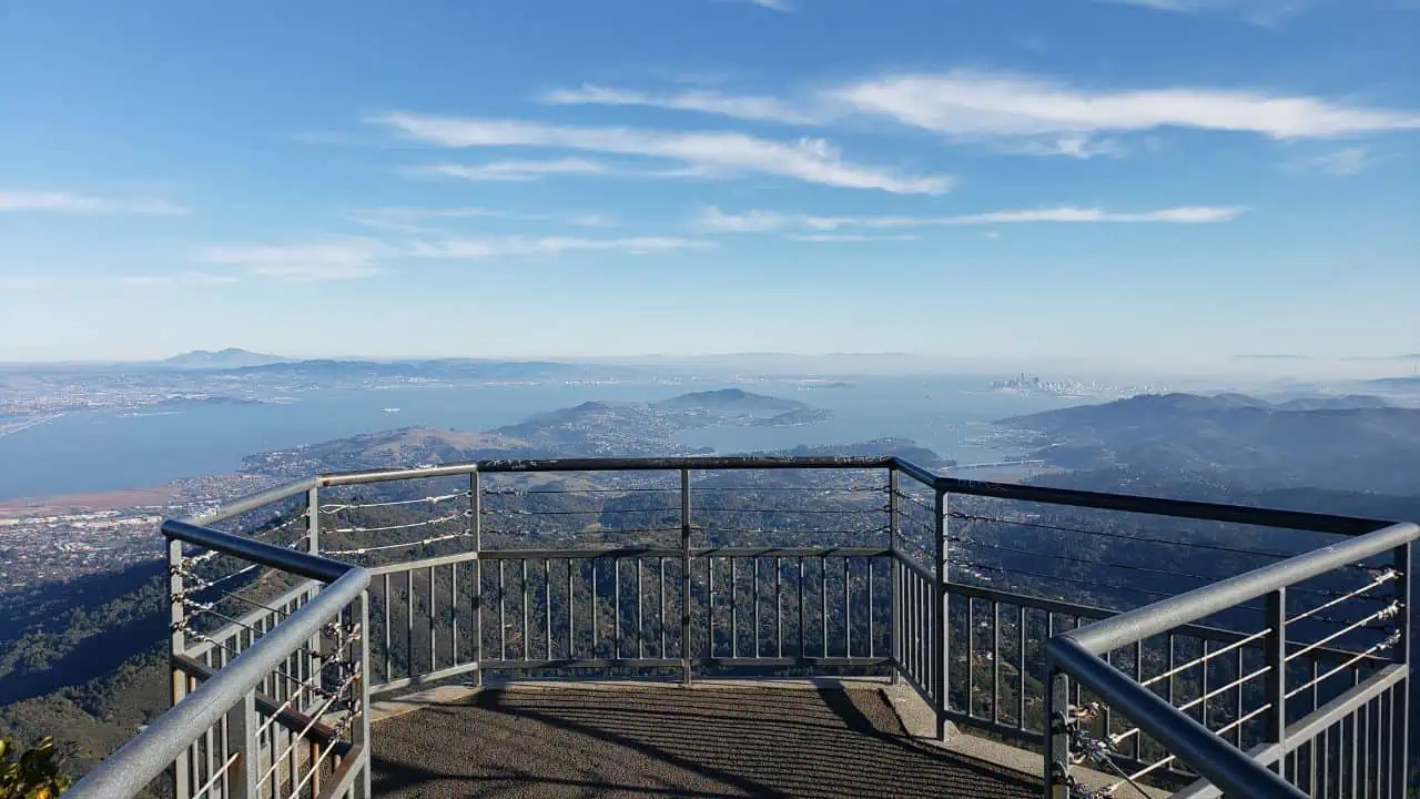
The panoramic view of the bay, the city, and the vast ocean beyond was like watching a live aerial shot. This hike was truly a poetic experience.
Key details of Mount Tamalpais East Peak Loop Trail:
| Detail | Description |
|---|---|
| Trail Name | Mount Tamalpais East Peak Hike |
| Location | Marin County |
| Trail Type | Loop trail |
| Difficulty Level | Easy, suitable for beginners and kids |
| Altitude | 2,571 feet |
| Views | Mt. Diablo (East), Mt. Saint Helena (North), the Pacific (West), and San Francisco (South) |
| Facilities | Restrooms, picnic tables, a gift shop, a museum, garbage cans, and drinking fountains |
| Dog Policy | Dogs are permitted on a leash |
| Navigation | Enter “Mt. Tamalpais Gravity Barn” into GPS, follow the route via Stinson Beach exit from Hwy 101, Hwy 1 west, Panoramic Highway, Pantoll Road, Ridgecrest Blvd |
| Trail Open Hours | 7 am to sunset |
| Parking Fee | $8.00 (cash only) |
| Length of the Loop | 0.7 miles |
| Accessibility | Wheelchair accessible |
| Special Features | Many benches and viewpoints along the path, plaques describing historical railway |
| Additional Warnings | Rattlesnakes and poison oak present, poor cell service |
| Extended Hiking Options | Other trails available for an all-day hike |
Tip: Pack a picnic and enjoy it with a view of the summit. And, of course, a good camera is essential to capture the stunning panoramas.
Mount Baldy Loop Trail – Conquering the Summit
The Mount Baldy Loop Trail in Angeles National Forest is an adventure that elevates you literally and metaphorically.
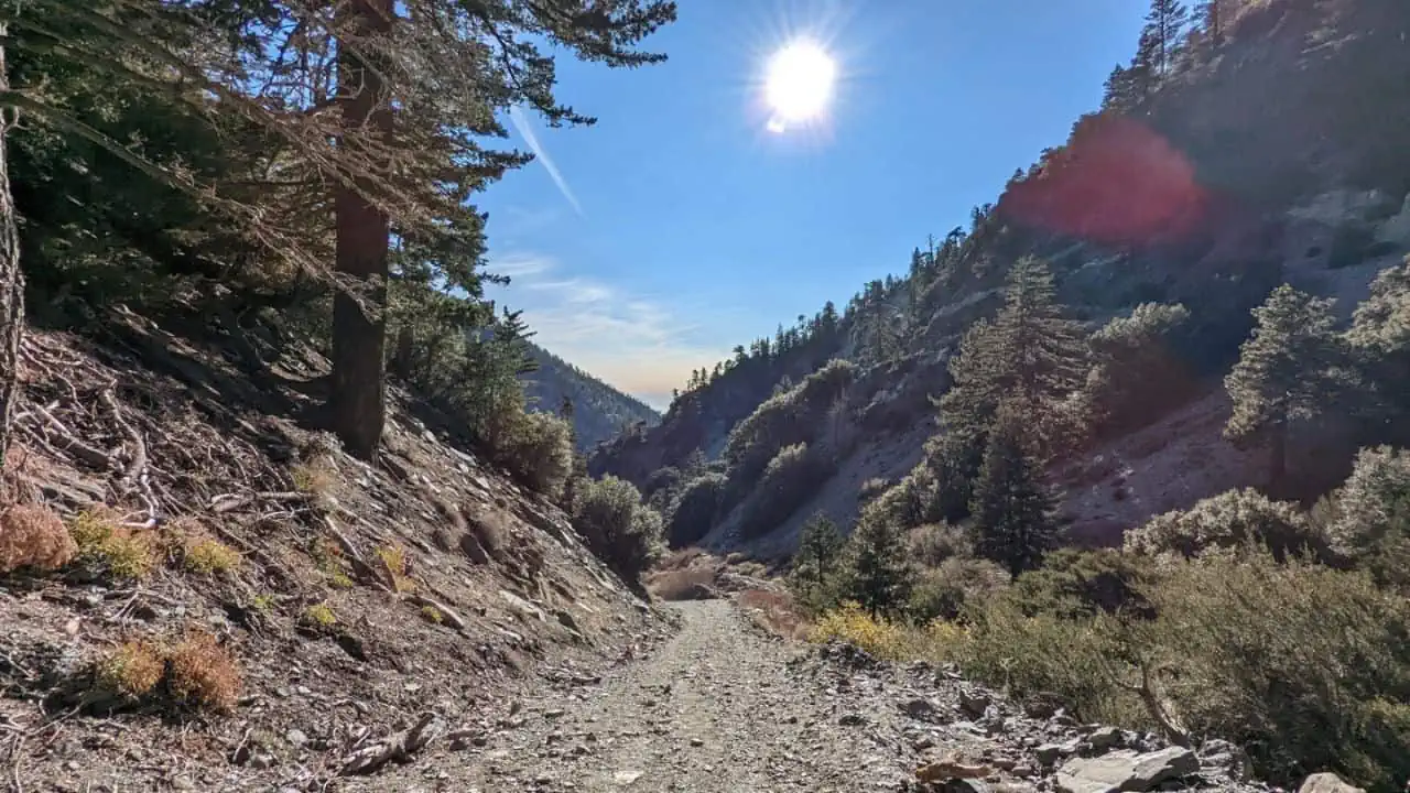
As I stood atop Mount San Antonio, the highest peak in Los Angeles County, the feeling of accomplishment was as thrilling as the panoramic vista.
The tough climb made the victory all the sweeter.
Key details of Mount Baldy Loop Trail:
| Key Details | |
|---|---|
| Mountain Name | Mt Baldy (Mt San Antonio) |
| Location | Los Angeles |
| Elevation | 10,064 feet |
| Hike Length | 11 miles |
| Total Climbing | Almost 4000 feet |
| Guide Contents | – When to hike – Where to park – Insider tips – Trail maps – Printable directions – Checking for snow and bad weather conditions – Training for the hike – What to bring |
| Views | From the Pacific to the Mojave on a clear day |
| Importance of Preparation and Caution | People can die on Mt Baldy if not prepared |
| Trail Location | New San Gabriel Mountains National Monument, Angeles National Forest |
Tip: Be prepared for some tough sections. Remember to pace yourself and keep hydrated.
Fern Canyon Loop Trail – Into The Jurassic
The Fern Canyon Loop Trail in Prairie Creek Redwoods State Park is like stepping into a prehistoric world.
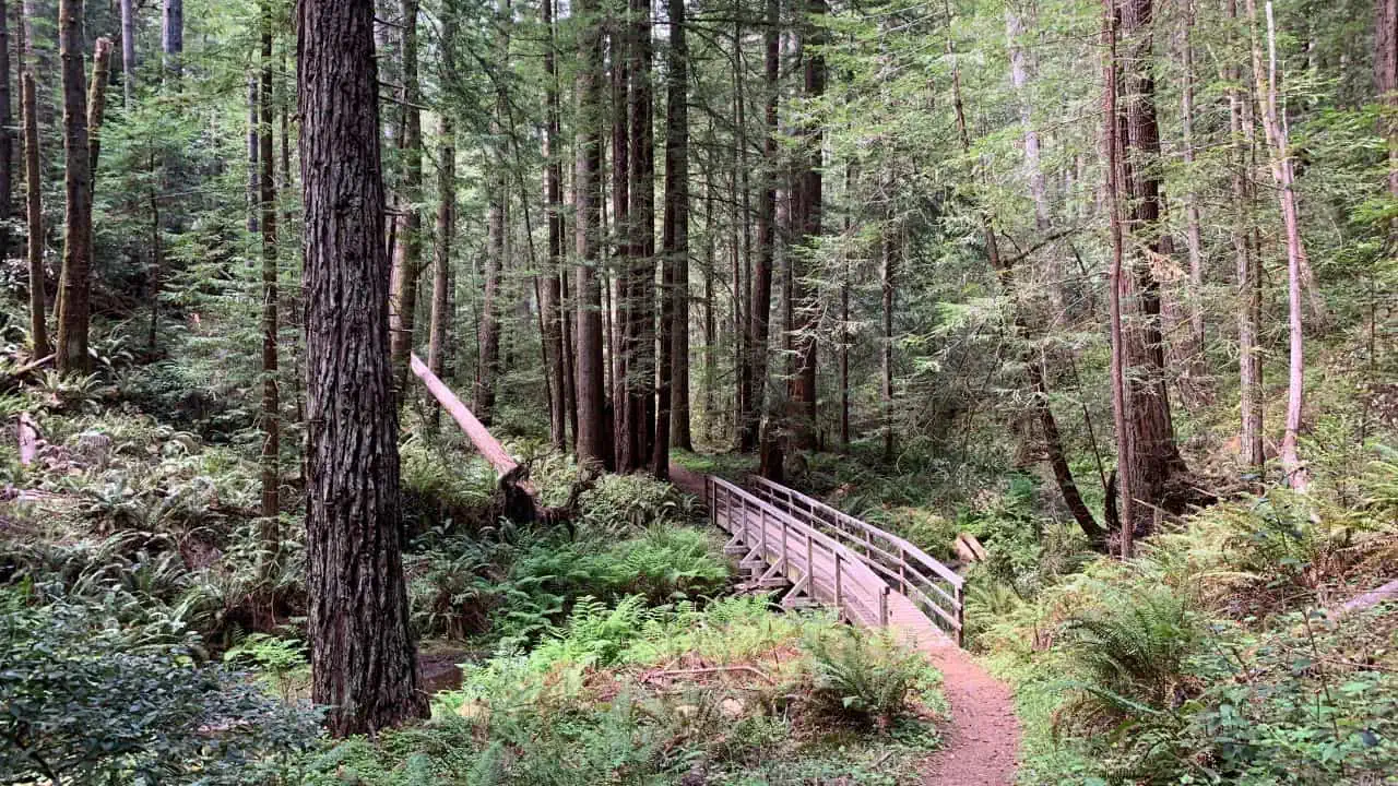
Meandering through the lush fern-lined canyon was a humbling experience. I found it hard to resist touching the age-old ferns and mosses that covered the canyon walls.
| Information | Details |
|---|---|
| Parking Reservation Requirement | Yes (from May 15th – Sept 15th) |
| Parking Reservation Application | Free online application |
| Hiking Permit Requirement | Not required for the 11-mile round trip |
| Trail Options | 1-mile loop or 11-mile round trip |
| Elevation Gain | 150 feet |
| Access to Fern Canyon via Prairie Creek | Yes, without any permit |
| Log Jams in Winter Floods | May require climbing through log jams |
| Wooden Footbridges | Installed from June to September |
| Recommended Footwear | Waterproof with good traction |
| Suitable Vehicle Type | Not suitable for large recreational vehicles |
| Entrance Fee | The trail is not ADA accessible |
| Roosevelt Elk | Frequently seen, maintain distance |
| Current Conditions Checking | Recommended before visiting |
| Restroom Facilities | Vault toilets available in the parking area |
| Accessibility | Trail is not ADA accessible |
| Pet Policy | Pets are not allowed |
| Hiking Duration | 45-90 minutes |
Tip: Bring waterproof shoes. There are small stream crossings along the trail. Also, keep your eyes peeled for elk in the park.
Bumpass Hell Trail – Nature’s Thermal Wonderland
Treading the Bumpass Hell Trail in Lassen Volcanic National Park was like walking on a different planet.
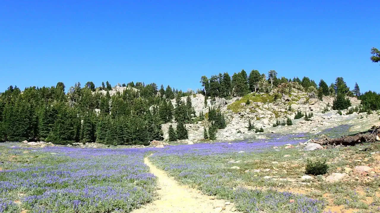
With its steaming fumaroles, boiling mud pots, and colorful pools, it’s an extraordinary demonstration of the Earth’s geothermal power.
The eerie yet captivating setting felt like exploring a sci-fi movie set.
Key details of Bumpass Hell Trail:
| Trail Name | Bumpass Hell Trail |
|---|---|
| Location | Lassen Volcanic National Park |
| Trail Availability | June to October |
| Closure Period | Winter and Spring due to snow |
| Round-Trip Distance | 3 miles |
| Time to Complete | Approximately 2 hours |
| Main Attraction | Largest hydrothermal area in the park |
| Starting Point | Bumpass Hell parking area, 7 miles from the Southwest Entrance |
| Elevation | 8,200 – 8,400 feet |
| Trail Surface | Packed gravel |
| Width | 48″ to the basin overlook, narrower on trails into the basin |
| Risks | Limited shade, winter conditions, unstable and dangerous ground in hydrothermal areas |
| Recommended Gear | Hat, water, proper footwear, trekking poles |
| Closure Information | Subject to closure due to snowpack, opening dates vary each year |
| Alternatives | Sulphur Works hydrothermal area, Warner Valley Area, Cold Boiling Lake Trail |
| Pet Policy | Pets are not allowed on the trail |
| Parking | Parking often full mid-morning to early afternoon, especially on weekends |
Tip: Stay on the designated paths. The geothermal area can be dangerous. And don’t forget to bring a hat and sunscreen – there’s little shade on this trail.
Final Thoughts on Best Hiking Trails in California
And there you have it, fellow trailblazers – my handpicked list of California’s most unforgettable hikes.
Whether you’ve been captivated by the majesty of the Redwood Empire, enticed by the wild allure of Yosemite, or mesmerized by the sun-kissed serenity of Joshua Tree, I hope my adventures and insights inspire you to lace up your hiking boots and discover these natural wonders for yourself.
Each of these trails has left an indelible imprint on my heart, as if to echo John Muir’s sentiment, “In every walk with nature, one receives far more than he seeks.”
Now it’s your turn. Whether you’re a seasoned hiker or just finding your stride, there’s a trail out there in the Golden State calling your name, offering more than just the exercise – it’s about the breathtaking views, the wildlife encounters, the whispering wind through the trees, and the memories you’ll cherish forever.
So, don’t just sit there scrolling. The best hiking trails in California are out there waiting for you to leave your footprints. Remember, every great journey starts with a single step.
Plan your hike, pack your gear, and let the boundless beauty of California’s trails become a part of your story. Who knows? Your next great adventure might just be a hike away.
Can’t decide which trail to start with? Well, that’s the beauty of it – there’s no wrong choice.
Whichever path you choose, I can assure you, it’ll lead to stunning vistas, life-affirming challenges, and an intimate connection with the very heartbeat of nature.
And don’t forget to drop a line in the comment section to share your experiences. After all, every hiker’s story adds a unique chapter to the grand book of California’s trails. See you on the trails, folks!
FAQs on Best Hiking Trails in California
What is California’s famous hiking trail?
The Pacific Crest Trail (PCT) is California’s renowned hiking trail, stretching through the Cascade and Sierra Nevada mountain ranges. As a national scenic trail, it offers long-distance hiking and equestrian opportunities, spanning from the U.S. Pacific coast. Enjoy the stunning scenery and challenging adventure along this iconic trail.
What are some of the best hiking trails in California?
California is blessed with a diverse range of landscapes, making it a hiker’s paradise. Some notable trails include the Pacific Crest Trail, John Muir Trail, Mount Whitney Trail, and the Lost Coast Trail. These trails offer everything from mountainous terrains to coastal views, and from short, easy hikes to multi-day adventures.
What is the biggest hiking trail in California?
The Pacific Crest Trail (PCT) is California’s largest hiking trail, stretching for more than 2,650 miles. Renowned for its breathtaking scenery, the PCT offers hikers a remarkable experience that goes beyond just elevation.
What month is best for hiking in California?
The best month for hiking in California is September to November. During these months, the weather remains warm and sunny, with the sun setting around 6:00 pm in October. This time also offers fewer tourists, resulting in less crowded trails. Enjoy the beauty of California’s trails during the fall season for an optimal hiking experience.
Are there hiking trails suitable for beginners?
Absolutely! There are plenty of beginner-friendly trails in California. An example is the Land’s End Trail in San Francisco which offers stunning coastal views or the Joshua Tree’s Hidden Valley Nature Trail, which offers a gentle, scenic loop.
Do I need permits for hiking in California?
Permit requirements vary based on the trail. For some trails, like the Mount Whitney Trail, permits are required due to the high volume of hikers. Other trails, like those in local parks, typically do not require permits. It’s best to check with local park services or the trail’s website before setting off.
What should I pack for a hiking trip in California?
Your packing list will depend on the trail you choose, the season, and the length of your hike. However, general essentials include a good pair of hiking boots, a map and compass, water, snacks, sun protection, and a basic first aid kit. For longer hikes, consider a backpacking stove, tent, and sleeping bag.
What is the best time of year to go hiking in California?
California’s diverse climates mean that there’s good hiking to be found year-round. Coastal hikes are great any time of year, while mountain hikes are best tackled in summer and fall to avoid snow. In spring, you can enjoy blooming wildflowers in the desert regions.
Are dogs allowed on hiking trails in California?
While many trails in California are dog-friendly, not all allow pets. It’s important to check specific rules for each trail. When dogs are permitted, they are often required to be on a leash. Some popular dog-friendly trails include Runyon Canyon in Los Angeles and the Point Isabel Regional Shoreline in Richmond.
Is there any danger from wildlife while hiking in California?
California is home to various wildlife, including bears and mountain lions. While encounters are rare, it’s important to take precautions such as carrying bear spray in bear country and not leaving food out overnight. Always check local wildlife advisories before setting off on your hike.
Are there accessible trails for individuals with disabilities?
Yes, California offers numerous accessible trails. These include the El Dorado Nature Center Trails in Long Beach and the Guy Fleming Trail in San Diego, which are designed to accommodate wheelchairs. Always check ahead for specific trail information and accessibility.